Place
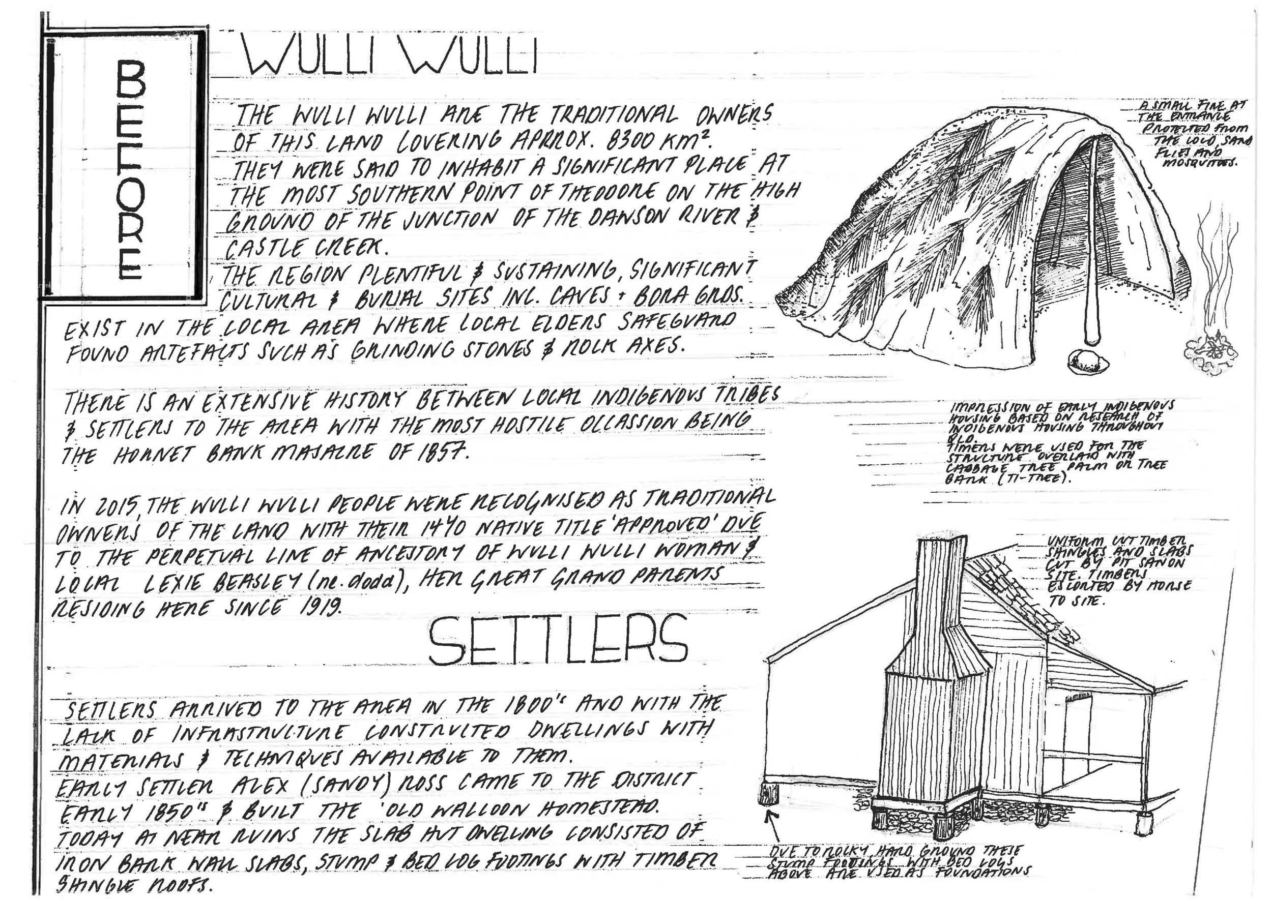
Imagine fertile lands covered in dense Brigalow scrub, bottles trees and prickly pear; Low ranges ringing the horizon. The subtropical and sub-humid climate, with variable rainfall, provides relatively pleasant conditions year round. At the junction of two water courses, The Dawson River and Castle creek is a fertile junction abundant in nourishment from both the land and water, we were told by a local elder this was a special place to the Wulli Wulli people. Being the traditional owners of this land; their country covering an approximate 8300sq km area, they would have fished and hunted porcupine, living off the banks of the Dawson River and within nearby caves. Significant cultural and burial sites including caves with a four fingered hand print and bora grounds (a male initiation site) exist in the local area where many artifacts, such as grinding stones, rock axes, and flake and core stones continue to be unearthed, the local elders their custodians.
The 1920’s irrigation schemes purpose built administrate center, Theodore now stands at this Junction and lies on the margin of the tail end of the Bowen and Great Artesian basins. The Bowen containing the largest coal reserves in Australia with the Great Artesian Basin being the largest and deepest basin in the world. Water is held in a sandstone layer, and provides white fellas the only source of freshwater through much of inland Australia.
The geological and tectonic history of the region is complex with the deposition comprising essentially Permian and Triassic rocks, some 46.7 million years old, beneath the surface of The Great Artesian Basin. Coal is known at several levels in this region (these measures along with those found in The Hunter Valley are among the most important sources of black coal in the Southern hemisphere) where metalliferous minerals are found on this margin of the basin also.
The extensive central plains and lowlands correspond closely to the Bowen basin as a geological structural entity. Resistant Mesozoic (think Jurassic Park) rocks form extensive tablelands, bounded by the Dawson and Expedition Ranges. This south central table land slopes gradually to the south, in accordance with the structure of the Mesozoic rocks. Believe it or not, Castle Creek flows the opposite way to the Dawson River and is speculated as a lasting testament to an inland sea. The Dawson is drained by the Fitzroy river system which includes the Mackenzie River.
History records show that white fellas came on the scene in the mid 1800’s, mostly to try their hands at cattle, sheep or growing crops. This initially took the form of a 30,000 acre grazing property called Woolthorpe that was eventually divided into a series of smaller stations such as Old Walloon and Camboon. As the plan for Theodore was developed these stations again had parts divided into workers blocks closer to the town.
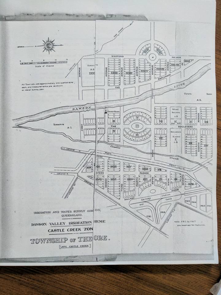
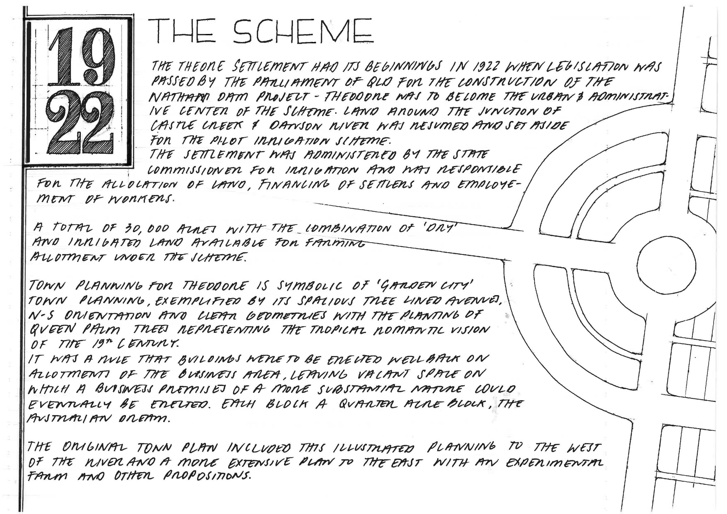
Originally called ‘Castle Creek’, the settlement was administered by the State commissioner of irrigation who was responsible for the allocation of land, financing of settlers and employment of workers, Theodore had its beginnings in 1922. Legislation was passed by the parliament of Queensland for the construction of the Nathan dam project; a pilot irrigation scheme for the country. Theodore was to become the urban and administrative center of the scheme. Land around the junction of castle creek and Dawson River was resumed where a total of 30,000 acres of land – the combination of dry and irrigated land available for farming allotment under the scheme.
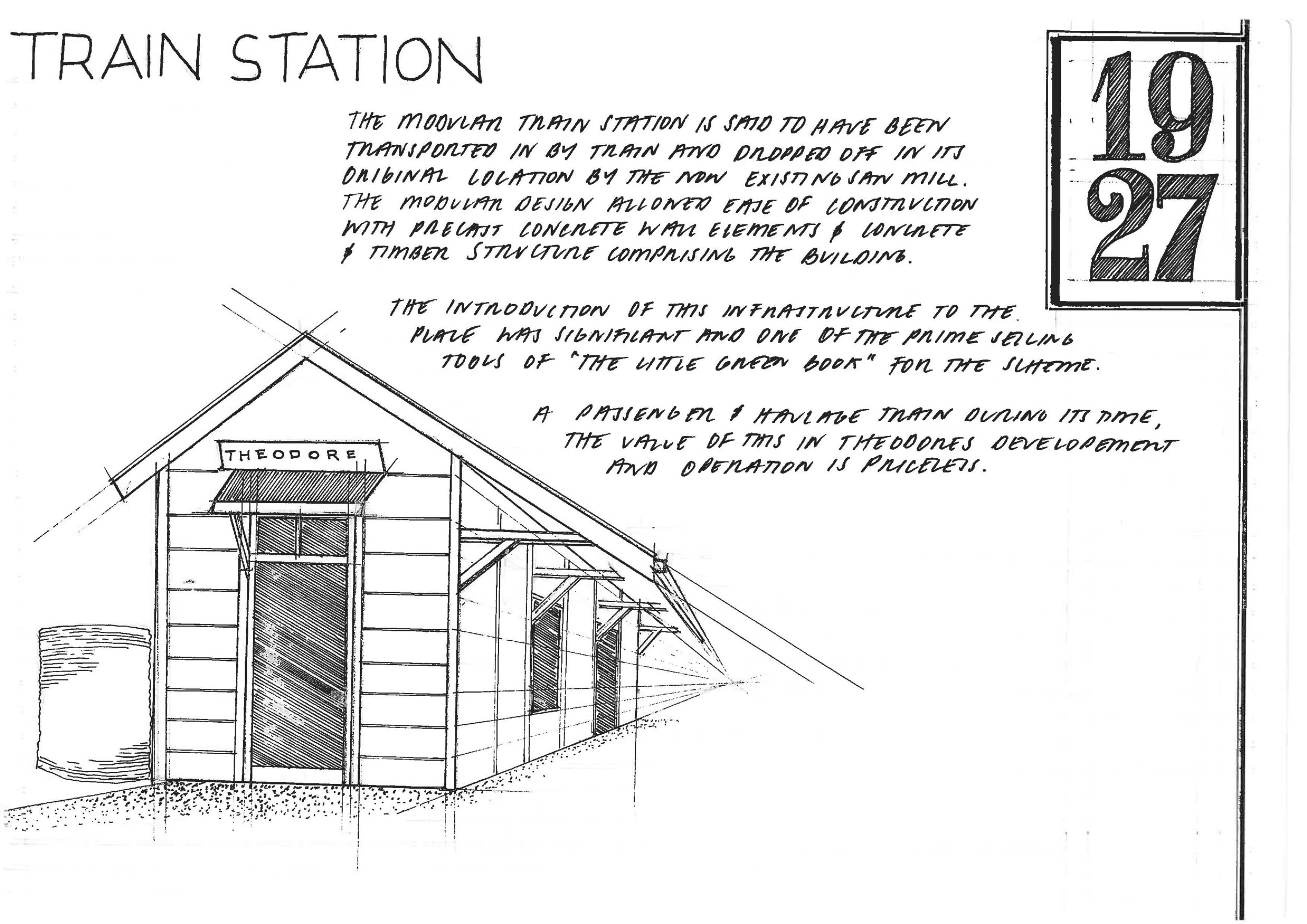
Applicants without experience and money could not be considered, because such persons would be burdens on the scheme, “spoon-feeding tends to develop a spineless community and dependence on the state” (little green book, Theodore promotional brochure, 1926). The whole scheme was designed as a gravitation supply, BUT until the Nathan Dam could be completed water had to be temporarily pumped from the river and carried by main canals and dis-tributaries to a water outlet on each farm.

'The Little Green Book' was a promotional brochure outlining the intent of the scheme, commissioner restrictions, housing and farming.
This was touted as “The Soundest Investment” for the settler, the solution “to prevent the city-ward drift of the younger rural generation…and a ready response of the increase in demand for the products of the soil”. The continual postponement of the Nathan Dam construction means that many farms are now no longer viable with other irrigation schemes benefiting from its faults, but the faults are still present. Some 95 years later, The Shire of Opportunity website claims;
The Nathan Dam Project: The Queensland Government is currently completing environmental impact study for the construction of the Dam to commence in 2012. The project will see The Dawson Valley become the next major development area in QLD.
Don’t worry; the locals say with a sly grin, they are still building the dam. Until then the people of Theodore help each other. Indeed, cooperation and a strong sense of community have characterized Theodore from its very beginning.
Today Theodore is home to around 1000 people, and has an impressive sense of itself and community. Supporting a diverse rural sector, the main industry of Theodore is cotton along with beef production and dry land cropping and irrigation. Coal mining is contributing an increasing part of the primary production. This rural town brings with it the common hardships of relying on the land, and times at present are tough. Water (which we are coming to learn is the consistent life source) had been scarce and expensive to feed crops and the land for cattle before Ex Tropical Cyclone Debbie (28-29 Mar 2017).
People
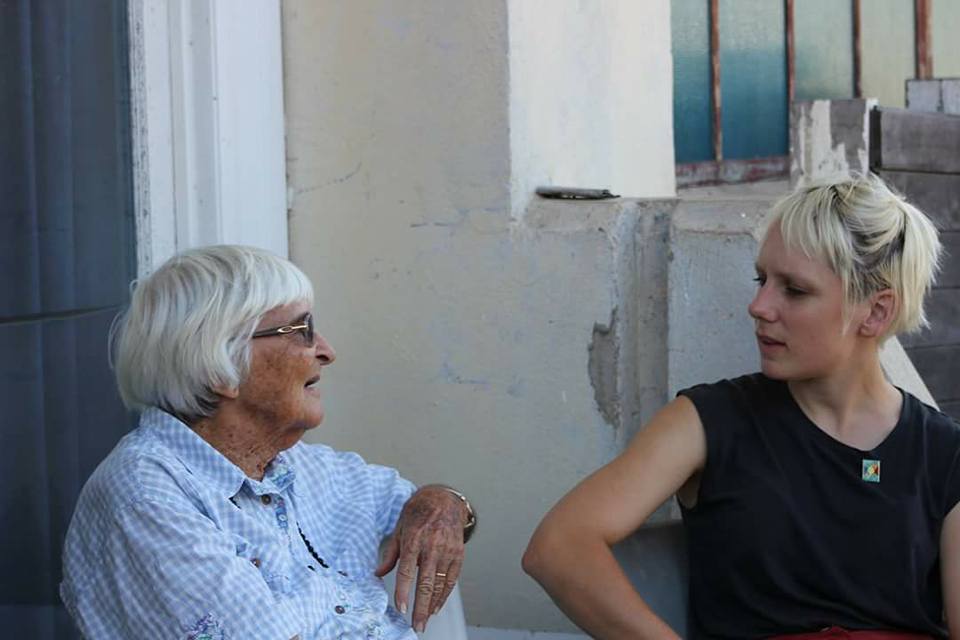
Lexie Beasley (nee. Dodd)
Local cattle stations, such as Camboon station, relied heavily on Indigenous labour during the war years and, as a result, enjoy a long and cooperative relationship with the local Wulli Wulli people.
It was the legacy of this station that in 2015, the Wulli Wulli people were recognized as traditional owners of the land with their 14 year native title claim successful due to the perpetual line of ancestry of local Lexie Beasley (nee. Dodd). Her great great grandparents resided here and working on the Camboon station since 1919, she talked to us of her long history with the place and much to our astonishment showed us records of ancestors being ‘removed’ to missions under The Aboriginal Protection and Preservation act at the request of fellow white citizens. This was often for not much more than harmlessly drinking alcohol, often leaving children and family to the care of other family.
Just staggering!.
We asked what the meaning of Native Title was to them and it means 'freedom of access’ to the local lands holding significant sites and burial grounds allowing them to hunt, learn and teach the younger generations about the land and a traditional way of life.
They showed us their growing personal collection of indigenous artifacts they personally safeguard, told us how much of a delicacy eating plump hibernating-ready echidna is and of some future plans on claimed lands. Bidding us farewell, Lexie warned us “look out for the junjadi”, the hairy and smelly man much like the boogie man that’ll get us. A lovely safeguard well wish.

Lexie & Les showing us their personal collection of artefacts from the area - grinding stones, rock axes, flake, core stones and gorgeous red ochres.
Keith & Liz Shoecraft
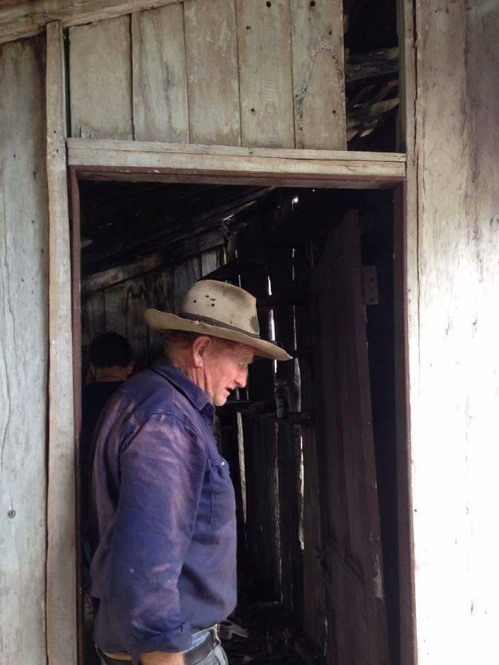
We were lucky enough to be shown around the beautiful town by a couple of local experts, Keith and Liz Shoecraft. Keith a local of 65 or so years has been a part of nearly every group and committee in town from the Hotel Theodore Cooperative board to the Chamber of Commerce and a Rotarian. Being the local bus drivers doing the school bus and mine worker runs they were walking encyclopedias of not only the anecdotal history of the town and its legends, but of lease histories, building dates & relocation's, the land, plants and trees. Keith and Liz knew it all. They generously gave us their time and were kind enough to drive all around the town, to neighboring communities and even to old Camboon, all accompanied with excellent stories about the good people and “those bad bahsterds” too.
Their children and grandchildren living just down the street gave us constant glimpses into changing generational perspectives of the town and its future. Time spent in company gave us great insights into the inner workings of the town and the prominent aspect of community at its core. We came to understand the inner workings and faults of the pilot scheme and the hardships of farming and life on the land.
The wonderful Keith and Liz Shoecraft, Proud locals and Rotarians who embraced our approach to australian travel and learning with humbling generosity. They essentially adopted us for the week. Made us feel like Theodore was home, cooked us meals and drove us all over the place filling our heads with fantastic stories and tales of people, plants and histories. We can't thank them enough and we will never forget Keith's wonderful "those bad Bahsterdes", in reference to some not so good characters in Theodore's history or Liz's never ending Bundy rum Christmas cake.
Holmes
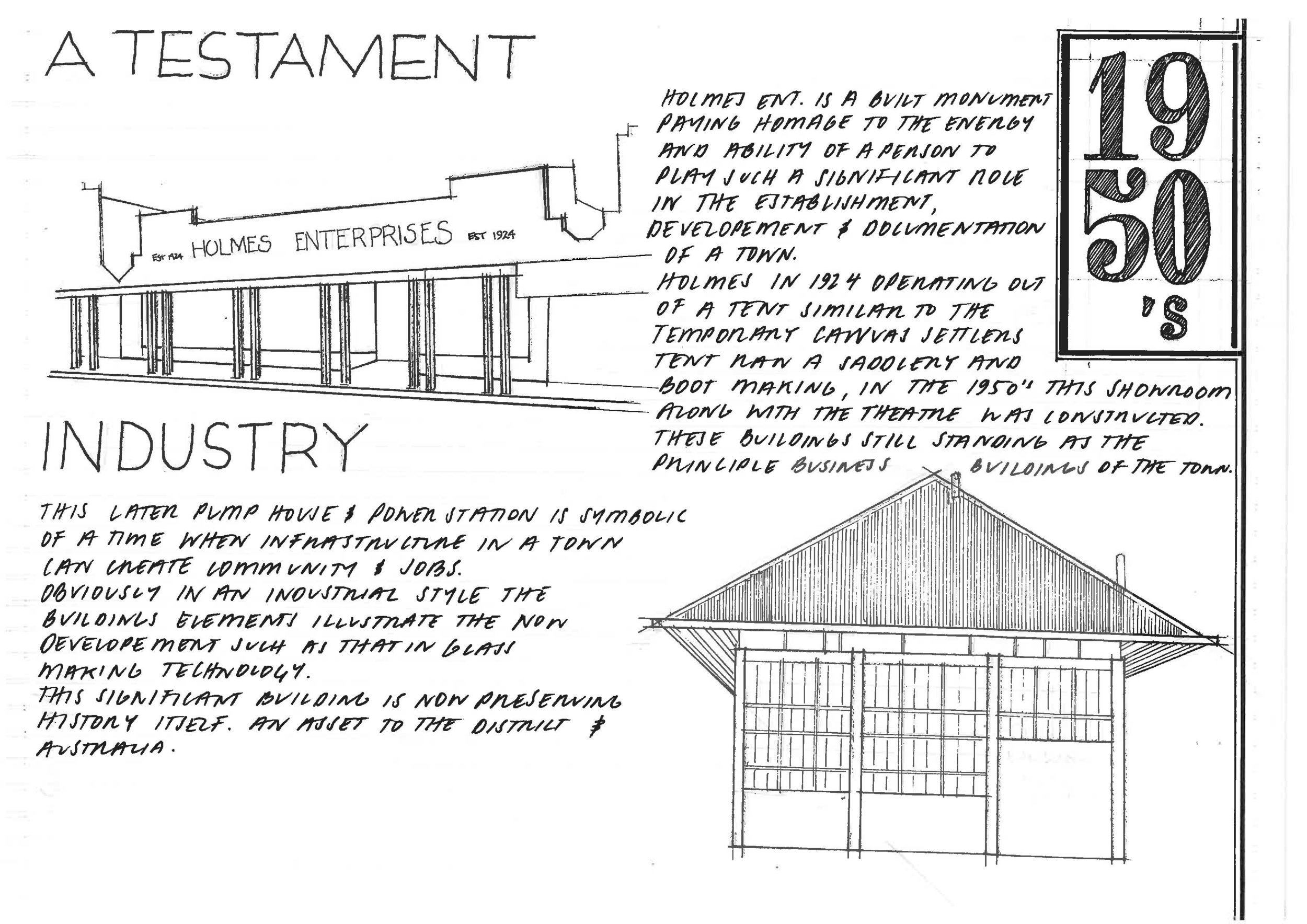
Allan Holmes; A man with great foresight, Theodore is steeped in this family’s history. The many books in the museum’s library stamped with his name of ownership, a vast majority of pictures and videos a reflection of his dedication to the development of the town over the years from the time of the town’s inception. Much of his documentation of the town has been claimed by Queensland archives as the best record of a town they have from its beginnings, all thanks to one man with great passion for his community and foresight. Allan Holmes was also a great visionary of architecture and used buildings as a manifestation of his own aspirations for Theodore.
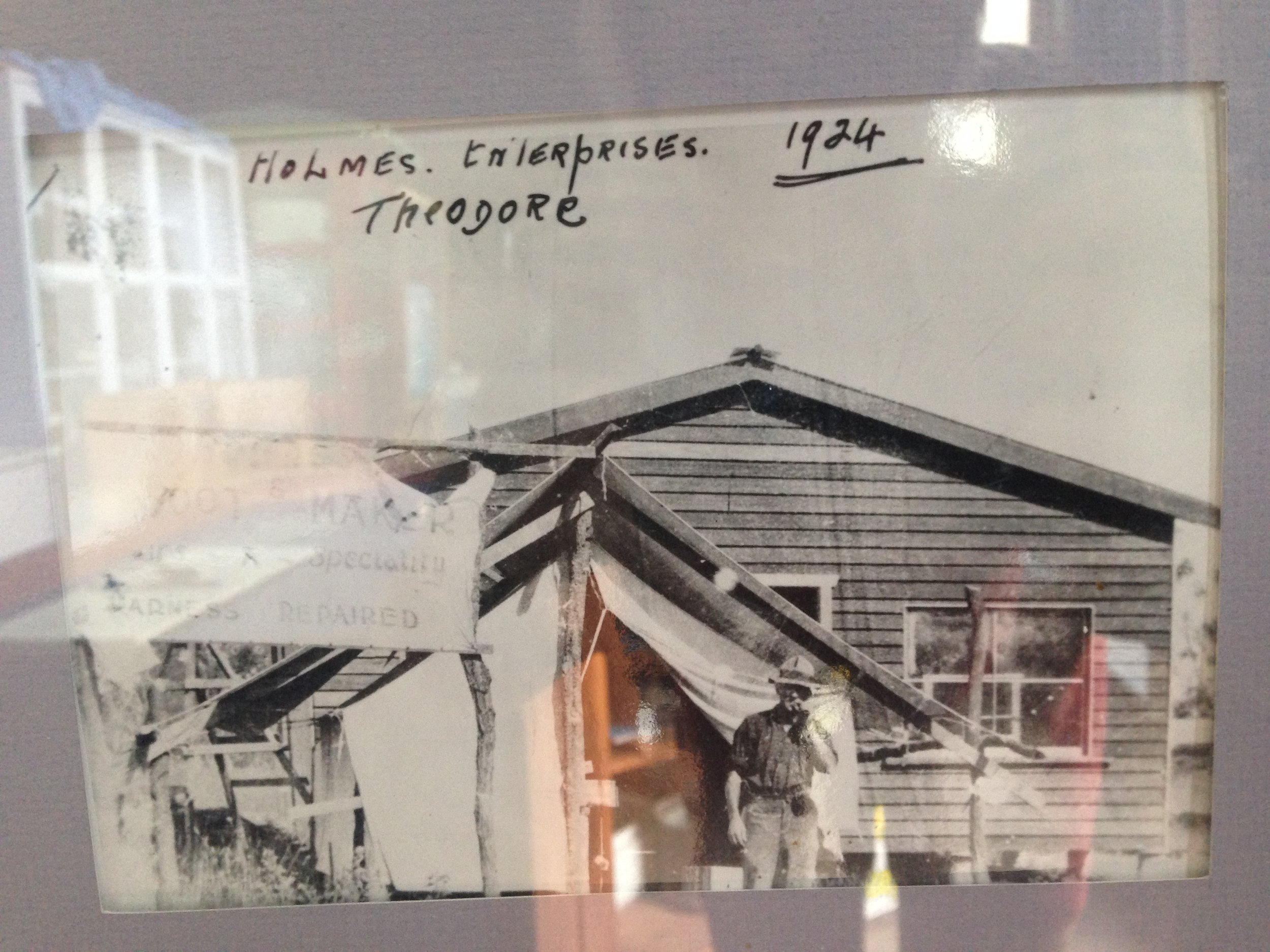
A man with great foresight and entrepreneurship, in 1924 A. Holmes set up a saddlery and boot making business at the front of his home to service the local town. His presence only greatened from there where still today the buisness district of the town consists of buildings genrations since own and operate out of.
Stuff (Architecture)
Little is known about the Wulli Wulli dwellings or infrastructure however research suggests shelters using green supple branches covered with cabbage tree palm or flattened Ti-Tree bark (a type of Malaleuca) would have been used. The women built a small fire at the entrance of each shelter to protect from the cold and the sand fly. In addition many caves in the area also bore evidence of continued habitation.

Wik repertoire of ethno-architecture. Reference imagery from Paul Memmot's Gunyah, Goondie & Wurley. Further literature in the Dawson Folk museum described huts as noted above particular to the area.
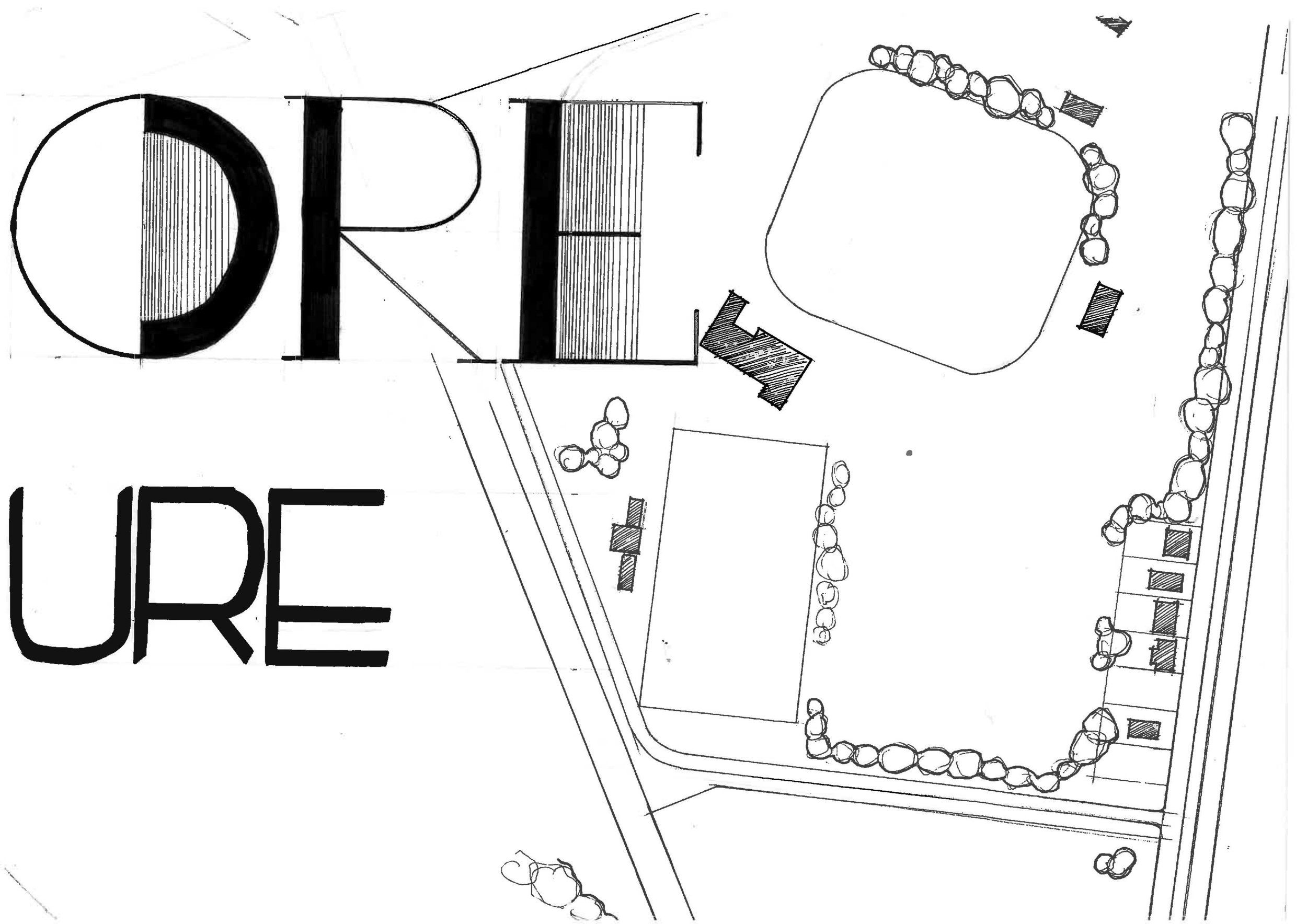
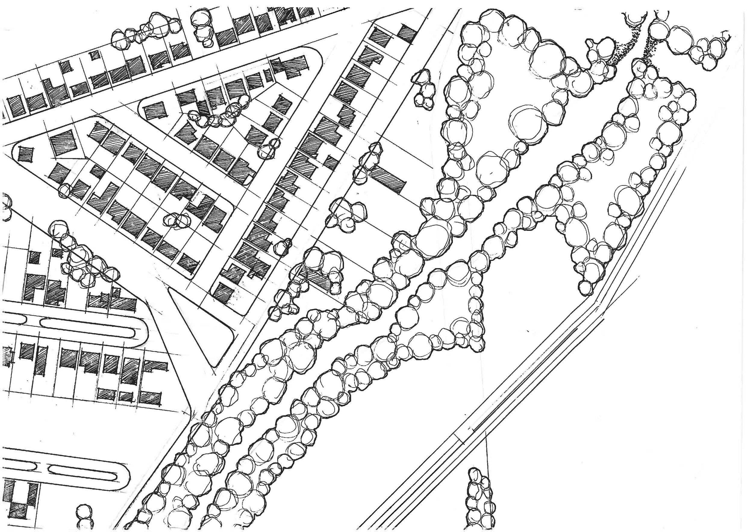
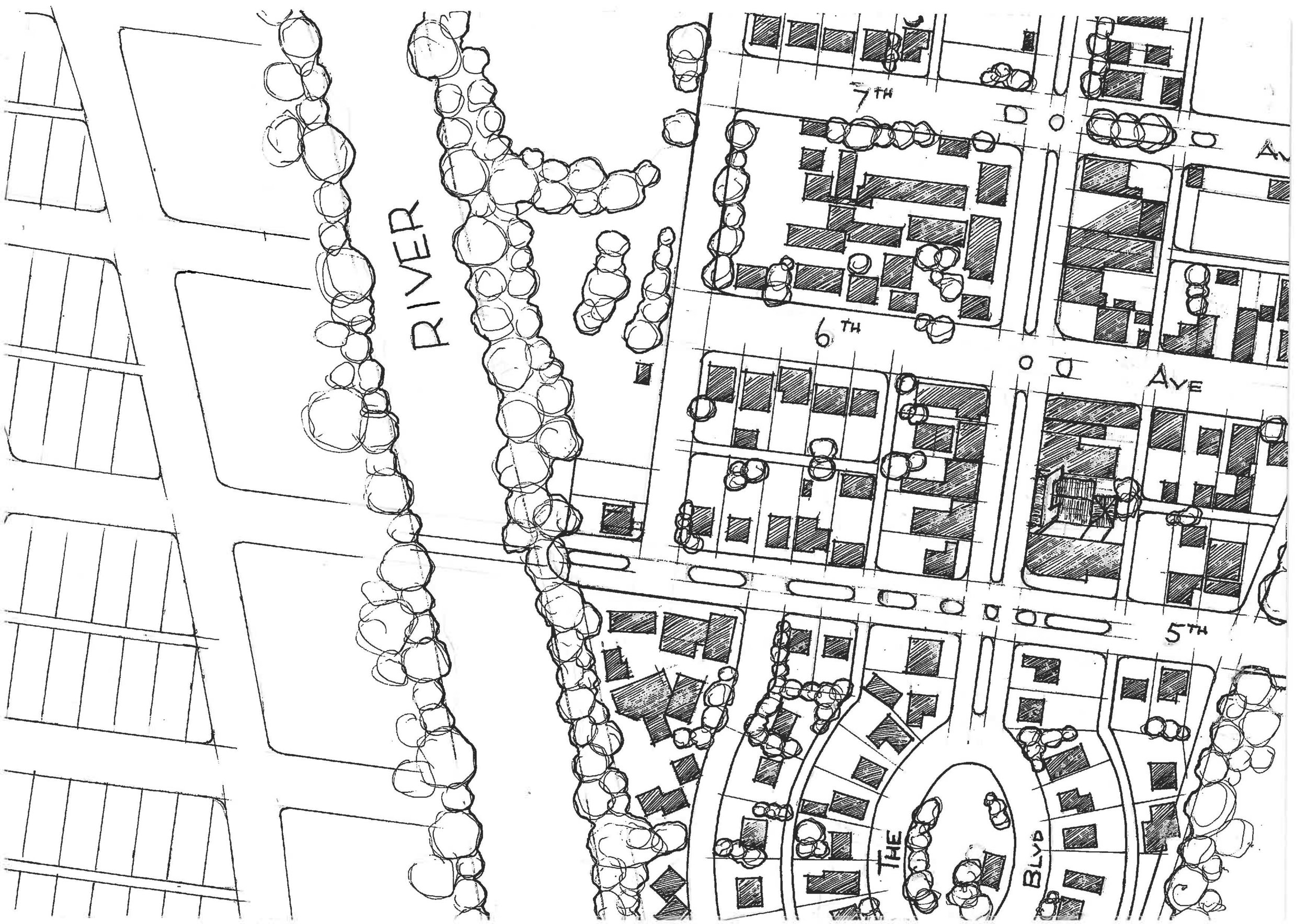
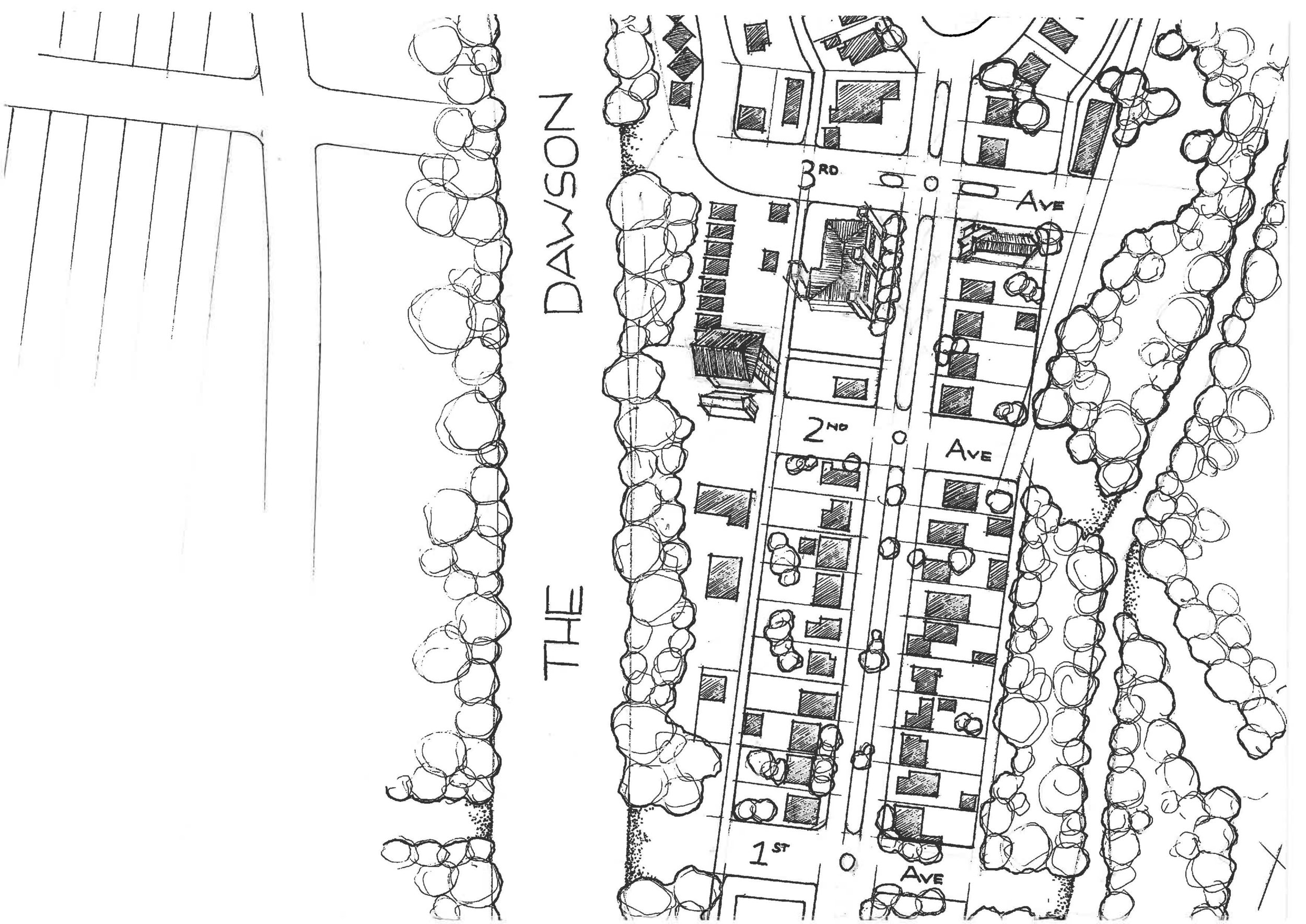
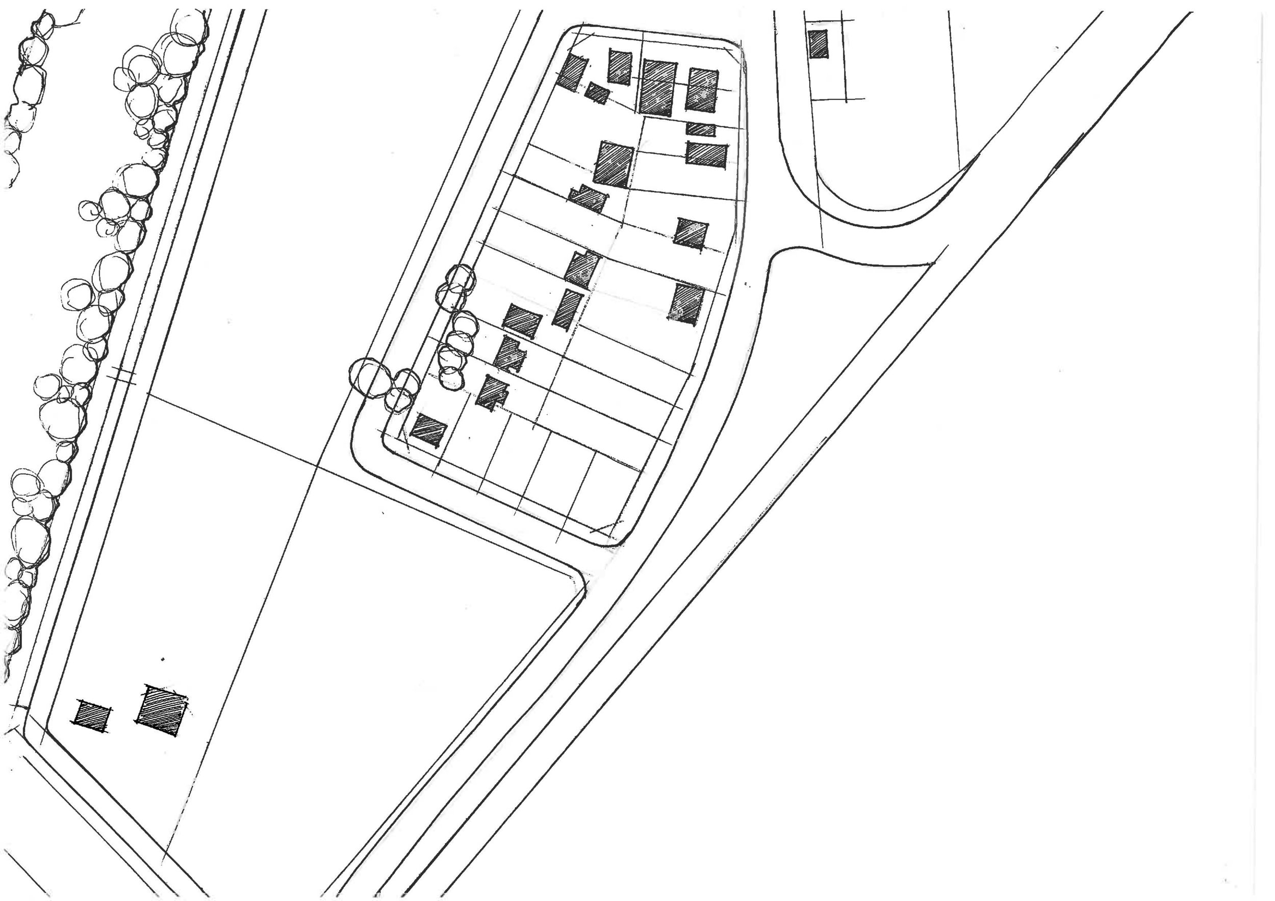
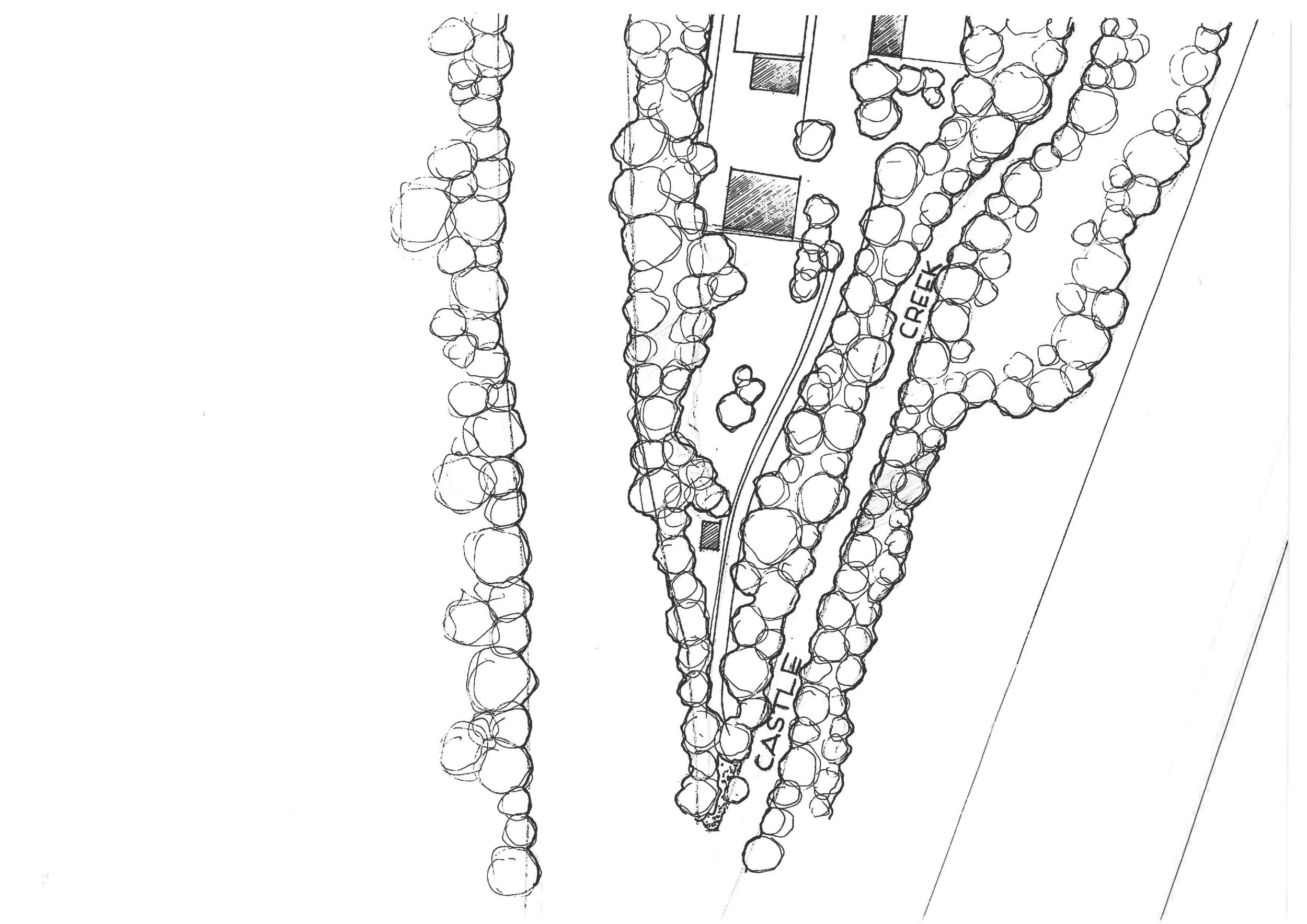
The most dominating architectural element of Theodore is undoubtedly the town planning. Rumoured to be designed by Walter Burleigh Griffin (never let the truth get in the way of a good story) the plan is symbolic of ‘garden city’ town planning, exemplified by its spacious tree lined avenues, N-S orientation and clear geometries with the planting of queen palm trees representing the tropical romantic vision of the 19th Century. The Boulevard is the connecting axis north south through the town terminating symbolically at the junction of Castle Creek and the Dawson River.
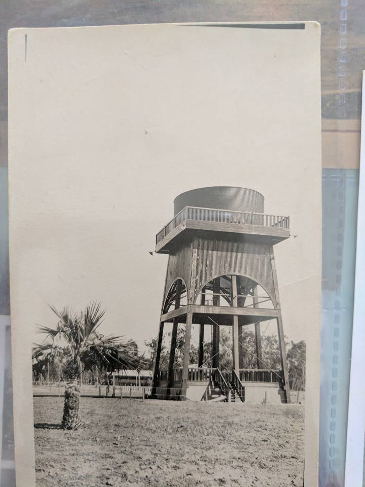
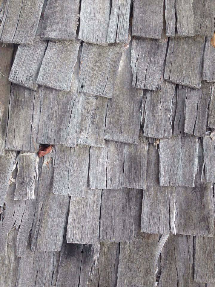
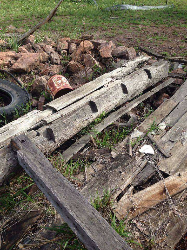
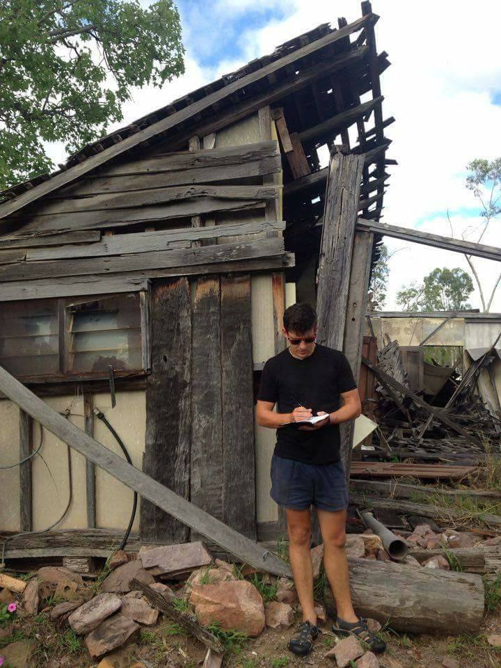
Early settlers to the area such as Alexander (Sandy) Ross at Old Walloon in the 1850’s constructed slab hut dwellings with hand chiseled rebates in large sturdy corner timbers with timber shingle roofs (later overlaid with iron), stump and bed log footings due to the rocky soils.
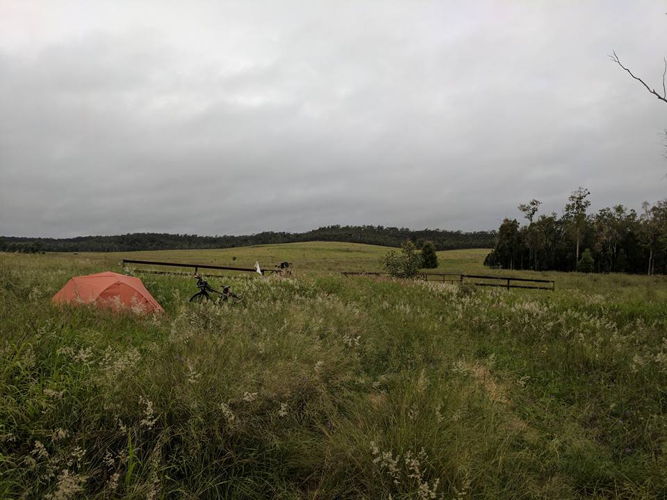
Permission was granted to settlers of the scheme in the 1900’s to reside under canvas or temporary dwellings during the first six months until the erection of a permanent abode. These transportable tents were commonly used during the Gold rush by miners and exhibited a dual skin or fly roof to keep the direct sun off the inner tent reducing heat gain, allowing a breathable air vent. (We have been using a similar set up after seeing this, yet with three skins – working a treat).
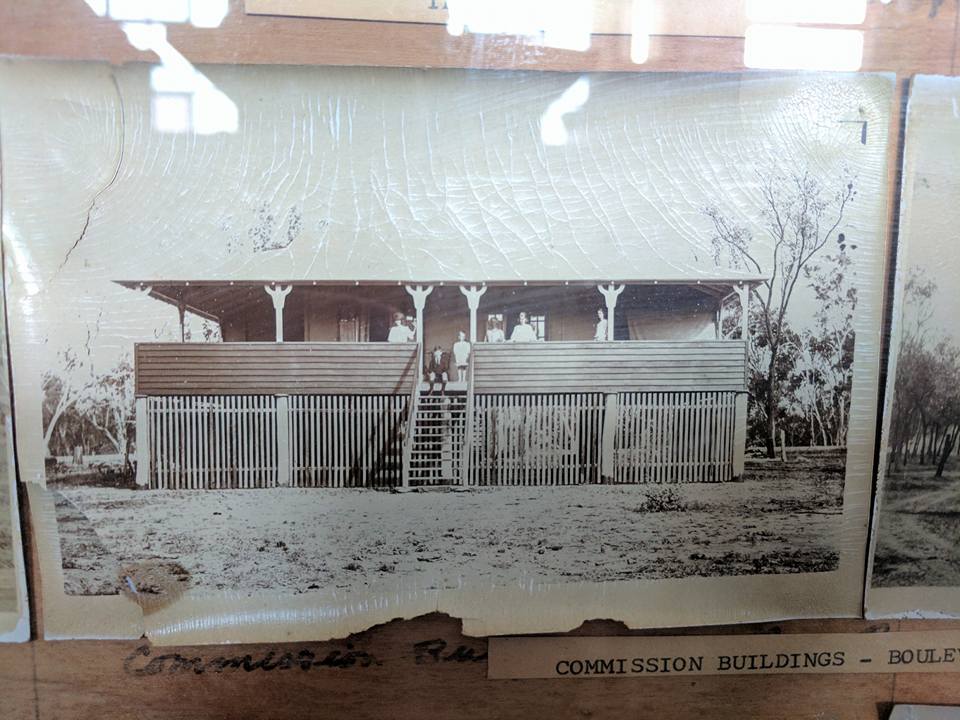

The grand facades along the street are a result of planning controls from the 1920’s. It was a rule that buildings were to be erected well back on each allotment, leaving vacant space on which business premises of a more substantial nature could eventually be erected. This has led to a homogeneous street scape with some substantial and aspirational buildings as a legacy to the aspiration of pioneering Australia. These plots in town were quarter acre blocks, the Australian dream.
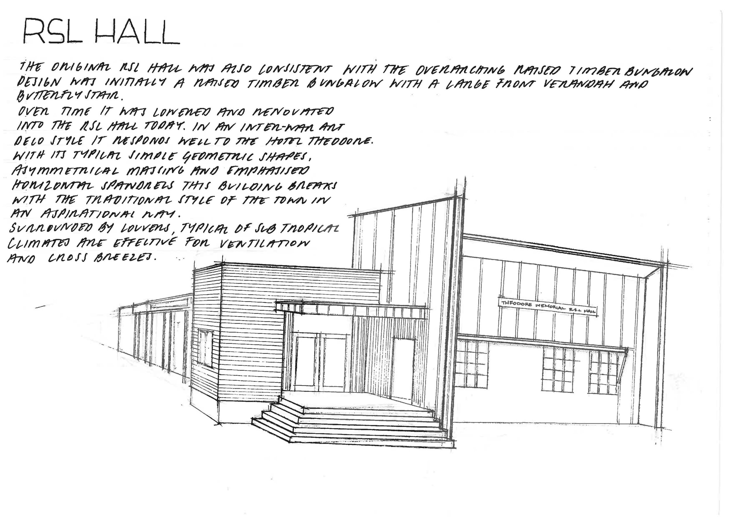
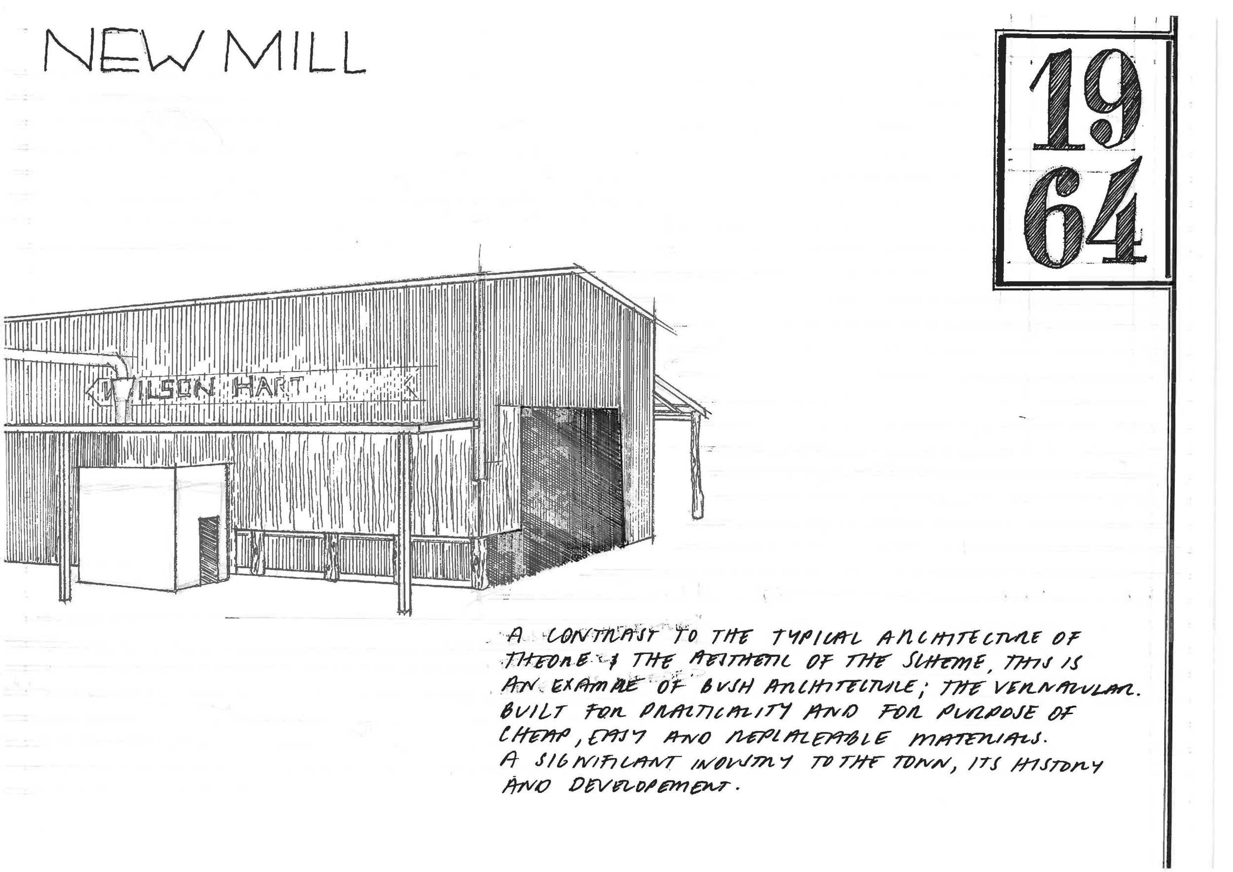
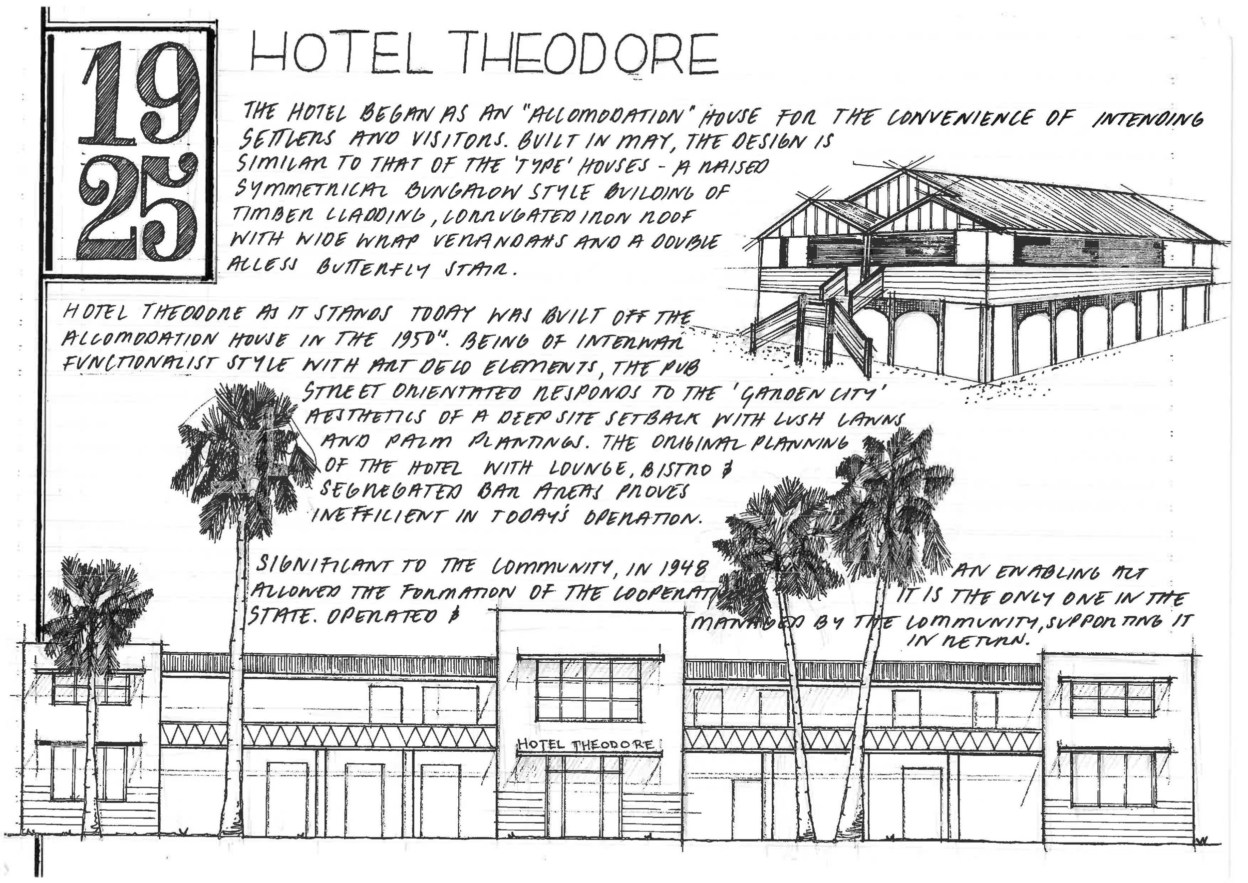
The building controls were strict on the style of buildings the commissioner allowed, favoring timber (from the town’s mill driving the clearing required by settlers), raised verandahed (a word we have made up; meaning with verandahs, but, LOTS OF EM) with a central front ascending staircase, and setback a respectable distance from the street where settlers were given a 'plan type' to ensure consistency. There are traces of this dominate architectural style of the town in today’s architecture despite the additions and subtractions of height over time. Aspirational buildings from the 1950’s dot the Boulevard, ranging from art deco and functionalist inspired facades to gold leaf lettering of the Castle Creek Picture Theatre.
Exhibition, Sunday 26th March.
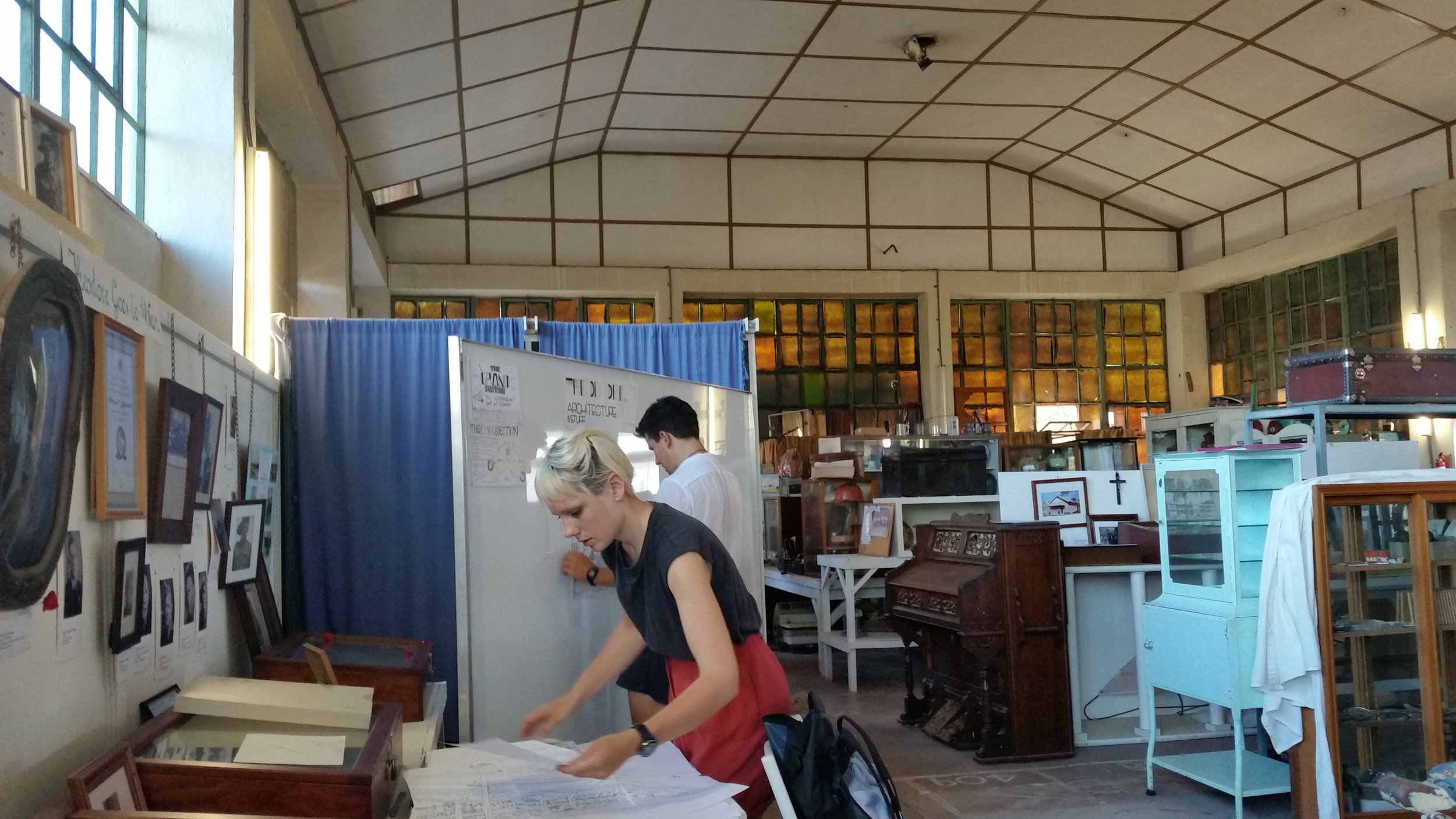
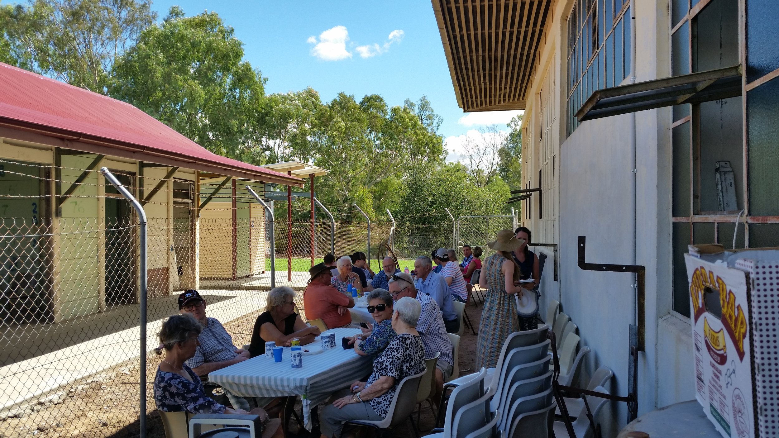
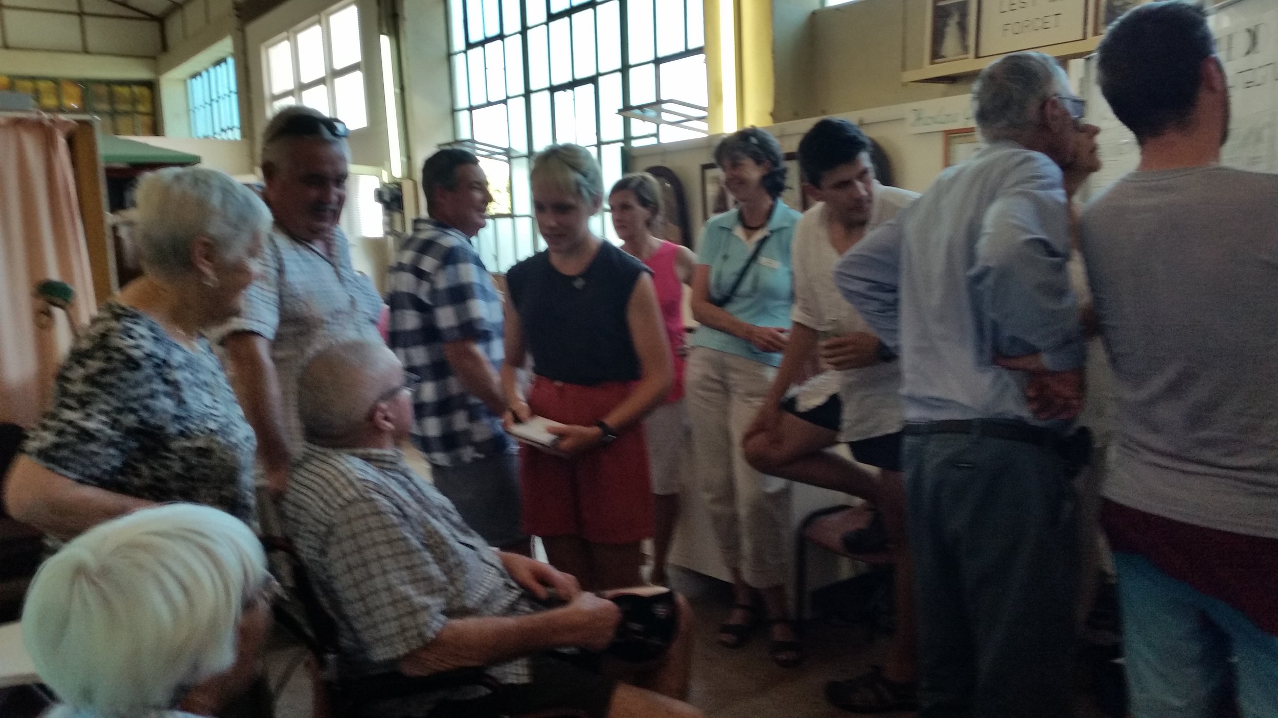
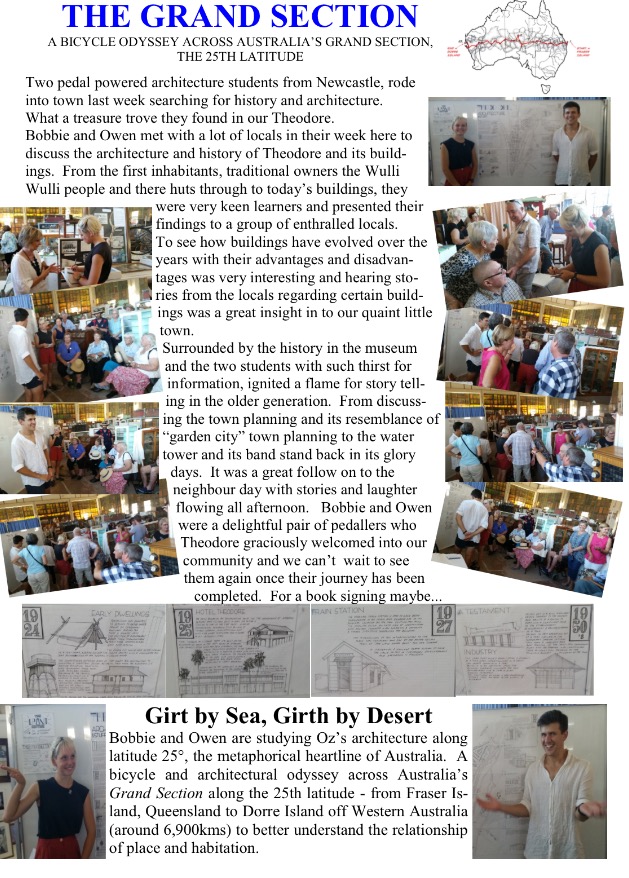
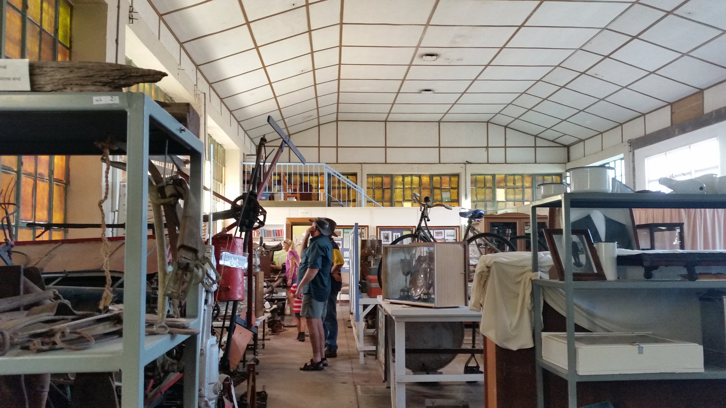

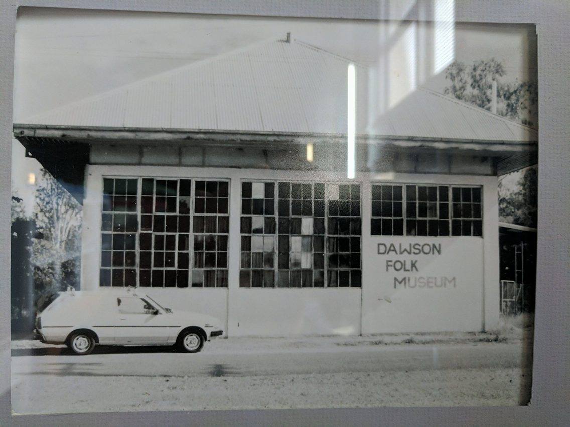
The Dawson Folk Museum, a wonderful old pump house and power station from the 1950’s, solid, industrial, imbuing a sense of stability and permanence was home to our exhibition and presentation. Earlier in the week as the volunteers of the historical society uncovered the exhibits and cleaned away dust ready to reopen for the season we sat and read and flicked through family histories and documentation. We were lucky enough to coincide on the Sunday with the Museums re-opening and a council initiative called “know your neighbor” so had our BIGGEST intentional AUDIENCE YET!! (About 30). There was a BBQ lunch and a great set up of tea, coffee, tables and chairs. Much better than what we usually offer.
Running late (due to frantically finishing the exhibition) we sped down to the museum arriving about 1pm, everyone wondering where we were exclaiming “they’re here!” upon arrival.
Whilst setting up, our audience with walkers and chairs, began to flow in ready for us to begin our presentation, also our most eager audience yet asking questions and inquisitively looking at our drawings amongst pinning up and preparing our talk sequence.
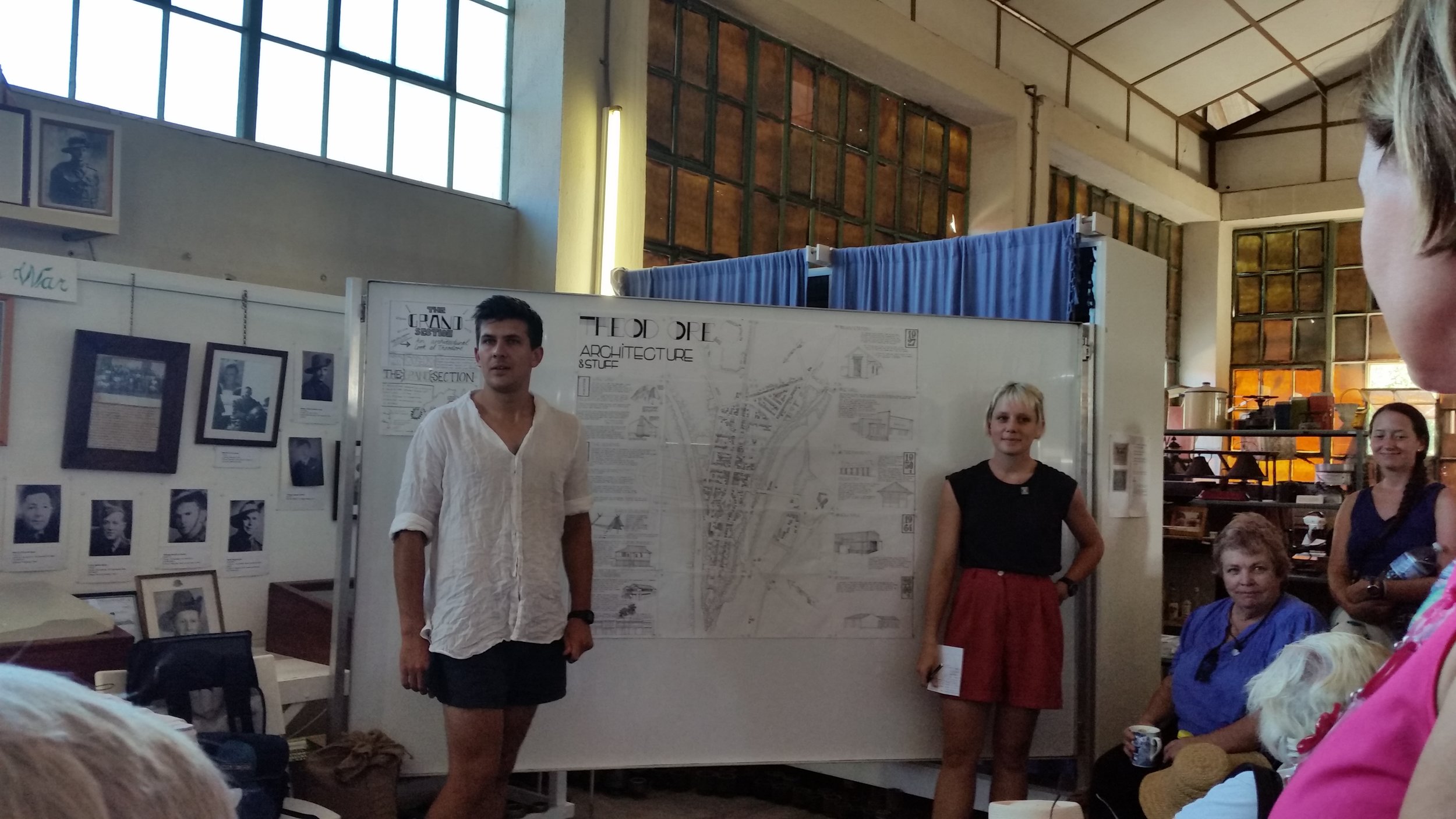
Not a great deal of breeze passed through the small, steel framed industrial windows during the presentation but all audience members focused intently on the entire show. Upon its conclusion we had great feedback and questions, a lot about the cycling and some about the presentation. Many of the locals and businesses asked for copies of the exhibition to put on display including the Museum, they thought it fantastic.
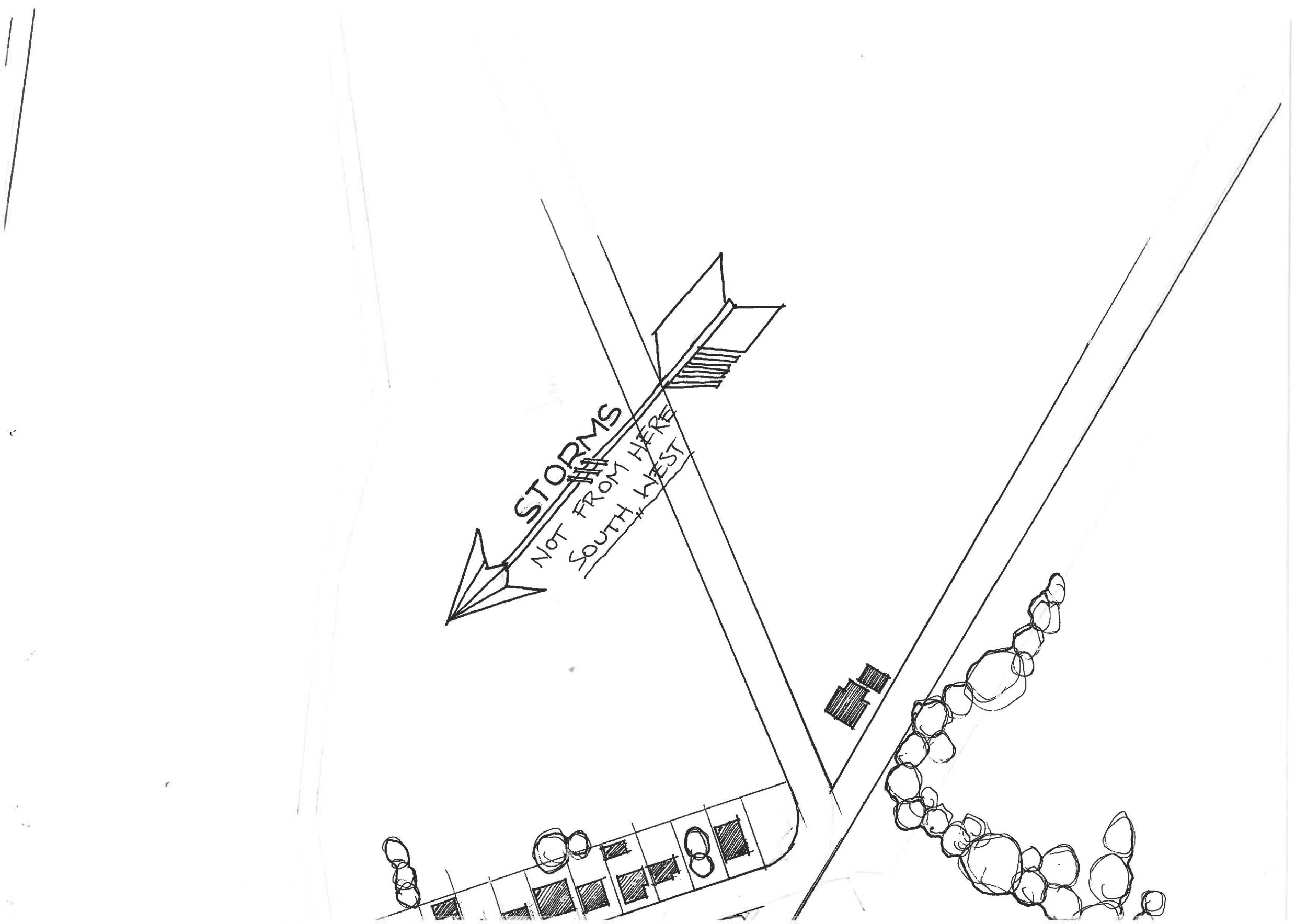
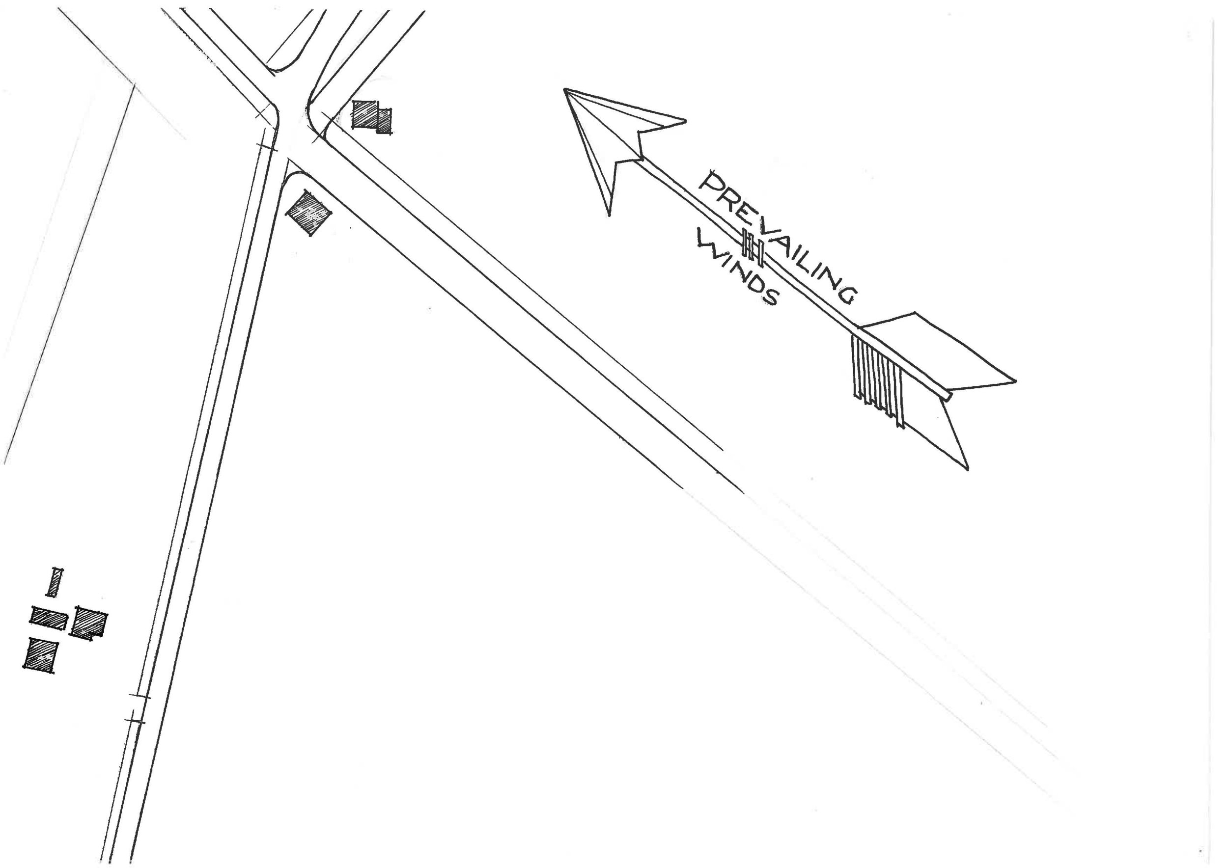
We received our best feedback yet, when an old cockie (country for farmer) named Owen (!) trundled up to Owen and said “I’ve talked to some of the other cockies and we are pretty sure the storms come from the southwest.” We had drawn north east.
We commented on the contrast of architecture today compared to those which had initially responded directly to the place. Today being low to the ground (ready for the flood), with a lack of eaves and generous outdoor space to protect from sun, wind and rain increasing ambient temperature of the house and surrounds requiring mechanical aid for heating and cooling. A disregard to context, built of non-local materials. Monica of the Historical society confirmed to us the importance to look at the place.


As a response to studying the history of architecture of Theodore, we came up with some suggestions:
- Keep in mind the soil type; black soil is reactive. Footings need to be able to accommodate the movement. Seen commonly in the older buildings, the use of piers are effective.
- Mind the flood zone; understand flood areas and levels. Piers double as a response to this to raise the dwelling above expected water levels. In previous flooding two-storey houses came out on top. literally.
- Aspirational design; can help grow a town and ensure a future. Effective public aspirational design can be hugely effective in improving and ensuring community spirit and moral.
- Movable & Adaptable buildings; are a common answer to construction. Materials & labour aren't readily accessible, so longevity and transport-ability is one to keep in mind.
- External shading; to the west is common and a good consideration for keeping sun off external walls hence lowering ambient temperature and heat gain.
In Transit (in reflection)
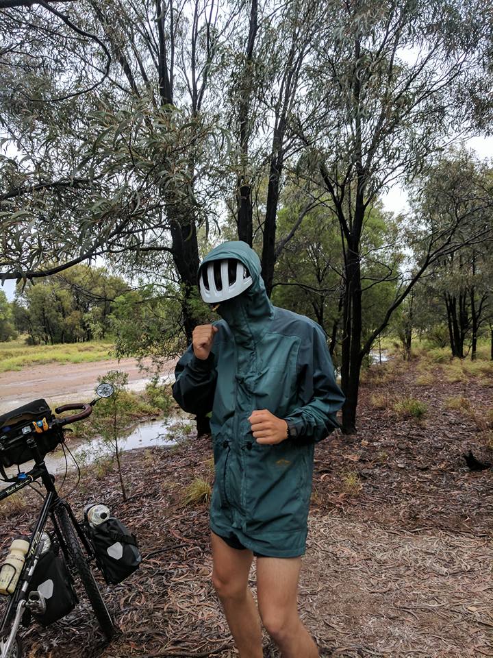
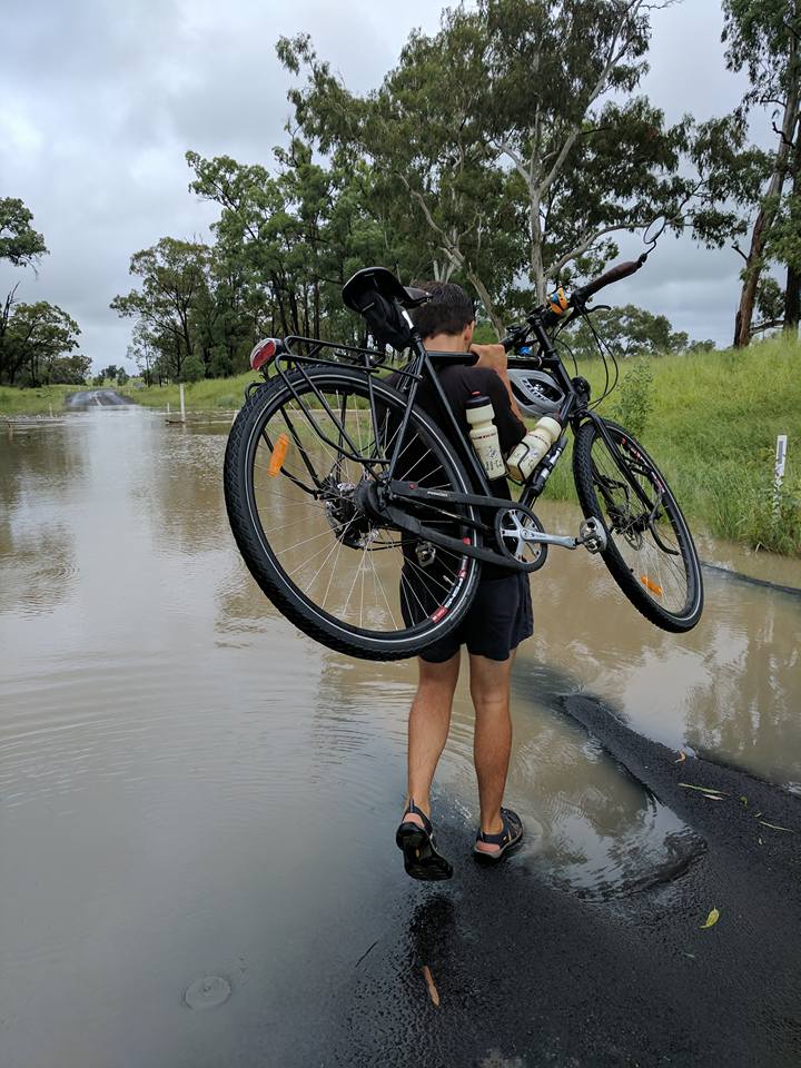
Next Stop Roma, four days of cycling. Upon departing locals said the rain was coming, cyclone Debbie was offshore at that stage, so we rode off unknowingly. Our first days ride out of Theodore brought us 20km shy of Taroom, passing Isla Gorge on the way, on the rim of the sandstone many horizons showed the table lands and ranges in its entirety. The South-West run to Roma with undulating terrain (nothing we aren’t used to) brought ex cyclone Debbie into our path, a hairy night and a day facing the aftermath though we were travelling through at the right time, water seeming to rise through crossings in our trail.
Night three brought us about 55kms out of Roma where Bobbie’s dad Chris and friend Gerard made an appearance at about midnight to join us on the last days ride into town and spend a day with us learning of the area. The headwind deterred him the next morning and instead we packed up the car of bikes and all heading to Carnarvon gorge to take in the surrounding country. A water induced detour took us to Injune and around to Mitchell and Roma a hugely intriguing drive. Past the Dingo fence and through large homesteads we came to the top of The Great Dividing Range some 500m’s elevation.
The Dingo fence, being the longest in the world, stretches from Jimbour to Darling Downs and is approximately 5300kms long, a scheme proposed in 1948 dedicated to the protection of the sheep industry. It meets at the point where the three states meet at Cameron corner, orthogonal divisions. This line is one which comprises the initial map drawn of our journey, quite significant to us. This line illustrates one of the overlade layers which comprise the country seemingly invisible to us generally on the coastal fringe. ‘Fences;’ a way we white fellas divide, claim territory and deter the unknowing stranger. Imagine a lack of!
A good one to ponder
“fences on the ground make fences in the mind” – The Greatest Estate, Bill Gammage


Edited by the wonderful Jen Richards!! What a woman!!